- Browse Category
Subjects
 We Begin at the EndLearn More
 - Choice Picks
- Top 100 Free Books
- Blog
- Recently Added
- Submit your eBook
- Browse Category
We Begin at the EndLearn More
- Choice Picks
- Top 100 Free Books
- Blog
- Recently Added
- Submit your eBook
Free eBook
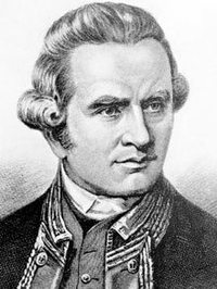
A Voyage Towards the South Pole and Round the World Volume 2
2019-02-21 00:57:51
Excerpt.......1774 June
On the 6th, being the day after leaving Ulietea, at eleven o'clock a.m., we saw land bearing N.W., which, upon a nearer approach, we found to be a low reef island about four leagues in compass, and of a circular form. It is
... Read more
Excerpt.......1774 June
On the 6th, being the day after leaving Ulietea, at eleven o'clock a.m., we saw land bearing N.W., which, upon a nearer approach, we found to be a low reef island about four leagues in compass, and of a circular form. It is composed of several small patches connected together by breakers, the largest lying on the N.E. part. This is Howe Island, discovered by Captain Wallis, who, I think, sent his boat to examine it; and, if I have not been misinformed, found a channel through, within the reef, near the N.W. part. The inhabitants of Ulietea speak of an uninhabited island about this situation, called by them Mopeha, to which they go at certain seasons for turtle. Perhaps, this may be the same; as we saw no signs of inhabitants upon it. Its latitude is 16° 46' S. longitude 154° 8' W.
From this day to the 16th, we met nothing remarkable, and our course was west southerly; the winds variable from north round by the east to S.W., attended with cloudy, rainy, unsettled weather, and a southerly swell. We generally brought-to, or stood upon a wind during night; and in the day made all the sail we could. About half an hour after sun-rise this morning, land was seen from the top-mast head, bearing N.N.E. We immediately altered the course, and steering for it, found it to be another reef island, composed of five or six woody islets, connected together by sand-banks and breakers inclosing a lake, into which we could see no entrance. We ranged the west and N.W. coasts, from its southern to its northern-extremity, which is about two leagues, and so near the shore, that at one time we could see the rocks under us; yet we found no anchorage, nor saw we any signs of inhabitants. There were plenty of various kinds of birds, and the coast seemed to abound with fish. The situation of this isle is not very distant from that assigned by Mr Dalrymple for La Sagitaria, discovered by Quiros; but, by the description the discoverer has given of it, it cannot be the same. For this reason, I looked upon it as a new discovery, and named it Palmerston Island, in honour of Lord Palmerston, one of the lords of the Admiralty. It is situated in latitude 18° 4' S. longitude 163° 10' W.
At four o'clock in the afternoon, we left this isle, and resumed our course to the W. by S. with a fine steady gale easterly, till noon on the 20th, at which time, being in latitude 18° 50', longitude 168° 52, we thought we saw land to S.S.W. and hauled up for it accordingly. But two hours after, we discovered our mistake, and resumed our course W. by S. Soon after, we saw land from the mast-head in the same direction; and, as we drew nearer, found it to be an island, which, at five o'clock, bore west, distant five leagues. Here we spent the night plying under the topsails; and at day-break next morning, bore away, steering to the northern point, and ranging the west coast at the distance of one mile, till near noon. Then perceiving some people on the shore, and landing seeming to be easy, we brought-to, and hoisted out two boats, with which I put off to the land, accompanied by some of the officers and gentlemen. As we drew near the shore, some of the inhabitants, who were on the rocks, retired to the woods, to meet us, as we supposed; and we afterwards found our conjectures right. We landed with ease in a small creek, and took post on a high rock to prevent a surprise. Here we displayed our colours, and Mr Forster and his party began to collect plants, etc. The coast was so over-run with woods, bushes, plants, stones, etc. that we could not see forty yards round us. I took two men, and with them entered a kind of chasm, which opened a way into the woods. We had not gone far before we heard the natives approaching; upon which I called to Mr Forster to retire to the party, as I did likewise. We had no sooner joined than the islanders appeared at the entrance of a chasm not a stone's throw from us. We began to speak, and make all the friendly signs we could think of, to them, which they answered by menaces; and one of two men, who were advanced before the rest, threw a stone, which struck Mr Sparrman on the arm. Upon this two muskets were fired, without order, which made them all retire under cover of the woods; and we saw them no more. Less
Related Books
View AllMr. Dide, His Vacation in Colorado, and Other Sketches
The Discovery of America by the Northmen, 985-1015: A Discourse Delivered Before the New Hampshire Historical Society, April 24, 1888 (Classic Reprint)
Wild Adventures Round the Pole - the Cruise of the "Snowbird" Crew in the "Arrandoon"
Rambles in the Mammoth Cave
The Cruise of the Snowbird: A Story of Arctic Adventure
The Sea: Its Stirring Story of Adventure, Peril, & Heroism. Volume 1
A Woman's Journey Round the World From Vienna to Brazil, Chili, Tahiti, China, Hindostan, Persia and Asia Minor
Travels in North America, From Modern Writers : With Remarks and Observations Exhibiting a Connected View of the Geography and Present State of That Quarter of the Globe
Oriente
Wonderland; Or, Alaska and the Inside Passage With a Description of the Country Traversed by the Northern Pacific Railroad
In the Oregon Country: Out-Doors in Oregon, Washington, and California, Together With Some Legendary Lore, and Glimpses of the Modern West in the Making (Classic Reprint)
Celebrated Travels and Travellers Part I. The Exploration of the World
From Ocean to Ocean
Voyages Amusants
Ascent of Denali (Mount McKinley): Narrative of the First Complete Ascent of the Highest Peak in North America
Incidents of Travel in Greece Turkey Russia and Poland Vol 2 Of 2
Alaska Days With John Muir
March to Magdala
The Mountains of Oregon
Voyage of the Paper Canoe A Geographical Journey of 2500 Miles From Quebec to the Gulf of Mexico
The Letters of Amerigo Vespucci and Other Documents Illustrative of His Career
The Life and Adventures of Bruce, the African Traveller
Norman Macleod
In the Tracks of the Trades: The Account of a Fourteen Thousand Mile Yachting Cruise to the Hawaiis, Marquesas, Societies, Samoas and Fijis
The Romance of Polar Exploration Interesting Descriptions of Arctic and Antarctic Adventure From the Earliest Time to the Voyage of the �Discovery�
Reviews
Sign in to write a review

Settings
Reflow text when sidebars are open.